 Argo floats in the polar oceans
Global Ocean Observing System 2026 Status Report card
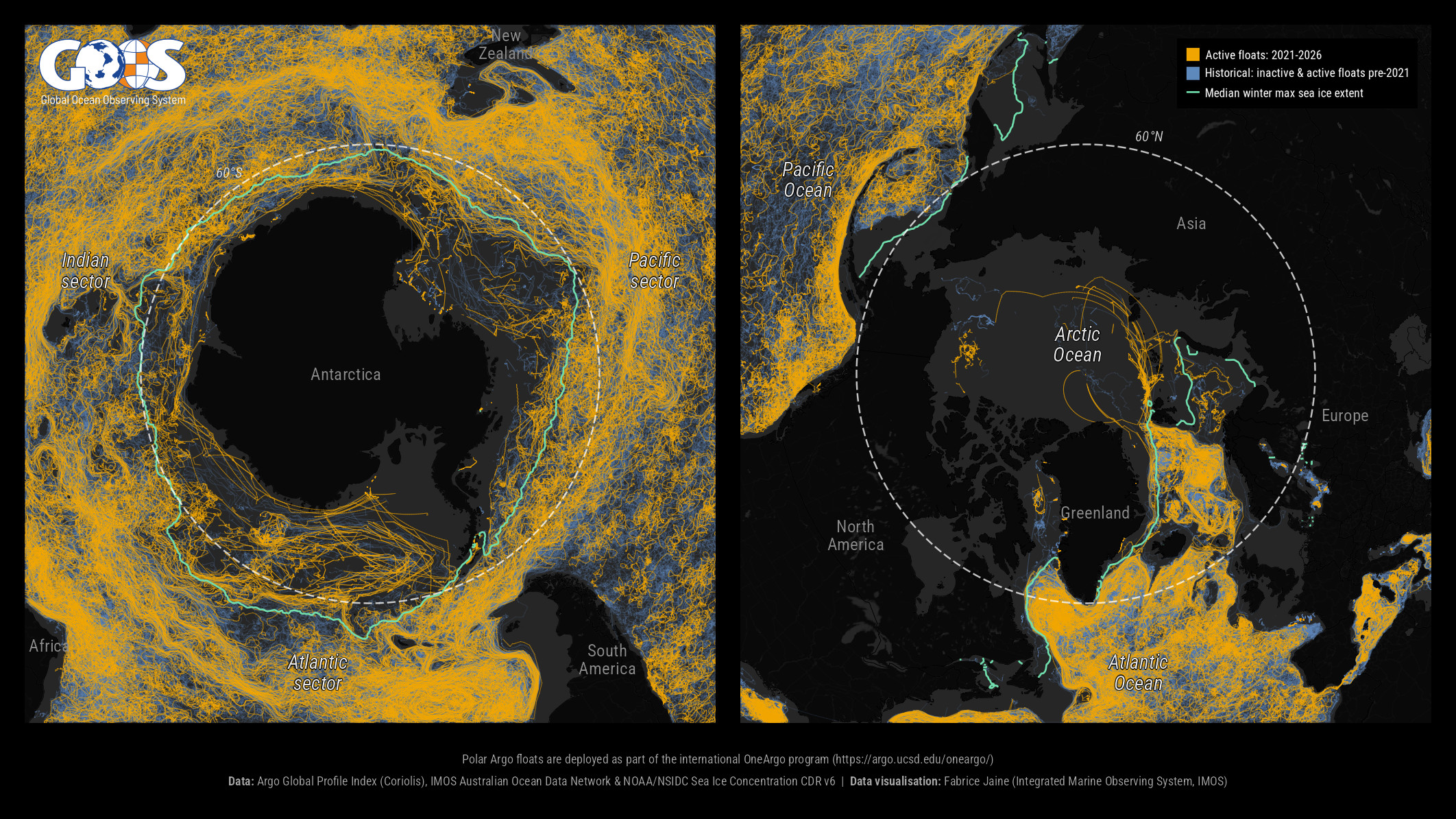
Created for the Global Ocean Observing System to feature in its 2026 Status Report card, this map showcases Argo monitoring efforts in the polar oceans. It brings together every Argo float track recorded around Antarctica and the Arctic: gold for floats active over the past five years, blue for older records, with the green line marking the median maximum extent of winter sea ice in each region. The visualisations illustrate recent coverage, even beneath the ice edge, and help reveal the coverage gaps that ocean observing systems can prioritise in the years ahead.
Data: Argo Global Profile Index (Coriolis); NOAA/NSIDC Climate Data Record of Passive Microwave Sea Ice Concentration, Version 6. Data visualisation: Fabrice Jaine (IMOS).